Features
Part of Value, upkeep and fit: a three-part test for unusual roadside stops
Spring flash floods compared with summer heat for unusual roadside stops in 2027
Spring flash floods and summer heat decide which named roadside attractions in 2027 are worth the drive, and which months suit each kind of site.
What to take away
- Spring flash floods and summer heat decide different unusual roadside stops in 2027. The month picks the site.
- Washes and slot canyons carry spring and monsoon flood risk. Check the National Weather Service forecast for the whole drainage, not the site.
- Low desert stops belong between November and March. High-elevation stops belong between July and September.
- Wildlife refuges peak from February through May, when bison calves and migrating birds arrive.
- Published drive times are minimums. Add buffer hours before you count stops against a daily ceiling.
Spring floods versus summer heat at named stops
A flash flood and a heat wave do not threaten the same places. Spring water runs through canyons and washes. Summer heat sits on open rock and sand with no shade. Safety comparisons by season miss the point. The useful question is which hazard your shortlist carries.
The 2027 calendar sets the dates: the spring equinox is March 20, the summer solstice is June 20, Labor Day is September 6, and Thanksgiving is November 25. Those dates shape crowds and daylight. They do not change the hazards.
Spring: water in the wrong places
The U.S. Fish and Wildlife Service describes migratory birds moving north from February through May and bison calves arriving on western refuges. The same season brings the thaw up north opening ice fissures and sending snowmelt downstream. For wildlife stops, that is the season.
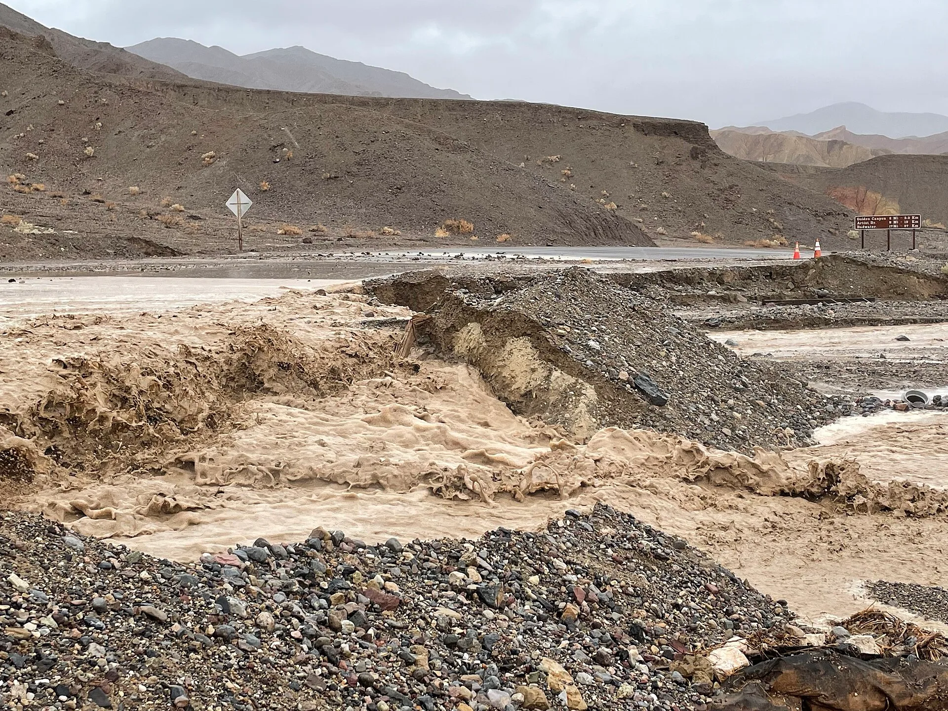
It is also the season with the most road risk. The BLM warns that a flash flood can happen quickly in canyons when precipitation is not absorbed by desert sands, and asks visitors to check local weather before heading out.
Name the sites this affects. Little Wild Horse Canyon in Utah's San Rafael Swell is a slot route with no high ground inside it. The Narrows in Zion National Park closes on flash flood forecasts. Both are spring problems, and both are decided by rain falling somewhere you cannot see.
Summer: heat on open ground
Summer reverses the map. High-elevation and northern stops come into season. Low desert stops go out of it.
Name those too. White Sands National Park in New Mexico, Craters of the Moon in Idaho, and the open petroglyph panels at Petroglyph National Monument outside Albuquerque all sit in full sun with no shelter. None is a midday stop in July.
Monsoon season returns the water problem across much of the Southwest, usually in the afternoon. The same washes that were dry at nine are running at four. A July stop can hold both hazards: heat at noon and flood water by late afternoon.
Autumn: the widest window
Autumn is the safest general choice. Roads are open, heat has dropped, storm risk is below spring, and usable light lasts longer into the afternoon.
Daylight shortens fast, though. A stop that worked at five in August will not in late October. Rebuild the timetable instead of reusing a summer one. The two ends of the season differ by well over an hour of usable light.
Winter: desert season and dark skies
Winter opens the low desert and closes almost everything at altitude. It is the best season for night-sky stops, because darkness arrives at a reasonable hour and the air is often clearer.
The trade is short days, cold nights, and a graded road that turns impassable after rain. Check with the managing office before committing a long approach.
A quick seasonal sort
| Site type | Named stop | Spring flood exposure | Summer heat exposure | Best 2027 months |
|---|---|---|---|---|
| Slot canyon | Little Wild Horse Canyon, Utah | High: no high ground inside the slot | Low to moderate: shade, but still hot | Autumn; spring only on a clear drainage forecast |
| Slot canyon | The Narrows, Zion National Park, Utah | High: closes on flash flood forecasts | Moderate: water and shade, with heat exhaustion risk | Late summer to autumn, when flow and storms allow |
| Desert dune field | White Sands, New Mexico | Low: water drains fast, but roads can pond | High: full sun with no shade | November to March, early |
| Lava field | Craters of the Moon, Idaho | Low to moderate: snowmelt, not flash floods | Moderate: high desert and exposed black rock | July to September |
| Petroglyph trail | Petroglyph National Monument, New Mexico | Low: arroyo crossings can run | High: open basalt with no shelter | October to April, morning |
| Wildlife refuge | National Bison Range, Montana | Moderate: unpaved roads muddy after rain | Low: northern refuge stays cooler | February to May, dawn |
| Night sky site | Chaco Culture, New Mexico | Moderate: graded access roads turn slick | Moderate to high: exposed canyon floor | Winter, moonless week |
Run the shortlist through the three-part test in odd stops compared for value, upkeep and fit, then match your kit to the month using what to pack for a trip built on odd stops.
Common questions
Which single month is safest for a trip like this?
October, across most of the country. Roads are open, temperatures are moderate, and flood risk runs below spring. Check state DOT road conditions before each leg.
How do I check flash flood risk?
Read the National Weather Service forecast for the entire drainage, not just the site, and stay out of canyons and washes when storms sit anywhere upstream.
Can desert stops be done in summer at all?
At dawn, briefly, with more water than you think you need. Midday visits to unshaded desert sites are not worth the risk. Local emergency services publish heat guidance for the county.
Do seasonal closures apply to odd stops?
Sometimes, especially where wildlife or nesting is involved. Call the managing office, whether that is NPS, BLM, a state agency or a private landowner, rather than assuming open ground stays open.