Guides
Part of Vintage highway signs worth a stop on Route 66 and other historic corridors
Bypassed alignments and painted walls: a two-day vintage highway signs route
A two-day driving plan for old highway signage, built around bypassed alignments, painted walls and one interpretive anchor, with timings that hold up.
What to take away
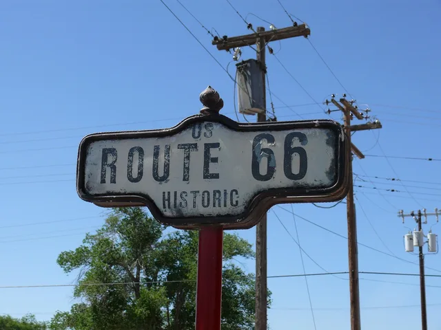
- Two days is enough for one corridor of bypassed alignments and painted walls. This vintage highway signs route runs the old Route 66 alignment from Madison, Illinois to Springfield, Illinois. Trying to cover two corridors wastes both.
- Day one runs the bypassed alignment, from Old Chain of Rocks Bridge to Pontiac. Day two works the towns along it, including Wilmington, Dwight, Odell, Lincoln, and Springfield.
- Anchor each day with one staffed site so there is a guaranteed stop with facilities. Use the Pontiac Route 66 Museum on day one and the Cozy Dog Drive In in Springfield on day two.
- Shoot east-facing signs in the morning and west-facing signs in the evening.
This is a working version of the shape, not the only version. The signs worth seeing move and the corridors do not. Apply it to whichever old alignment is near you, and the two-day pattern will hold up.
Day one, morning: Old Chain of Rocks Bridge to Litchfield on the bypassed alignment
Start at Old Chain of Rocks Bridge in Madison, Illinois. The 1929 bridge carried Route 66 across the Mississippi River. Cars no longer use it, but pedestrians and cyclists can cross. Drive the old alignment through Granite City, Edwardsville, and Hamel.
The old road separates from I-55 and runs through town centers. Expect to average well under highway speed. Drive with the sun behind you.
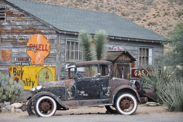
This is where route markers, distance posts, and filling station relics survive, because nothing has needed to replace them.
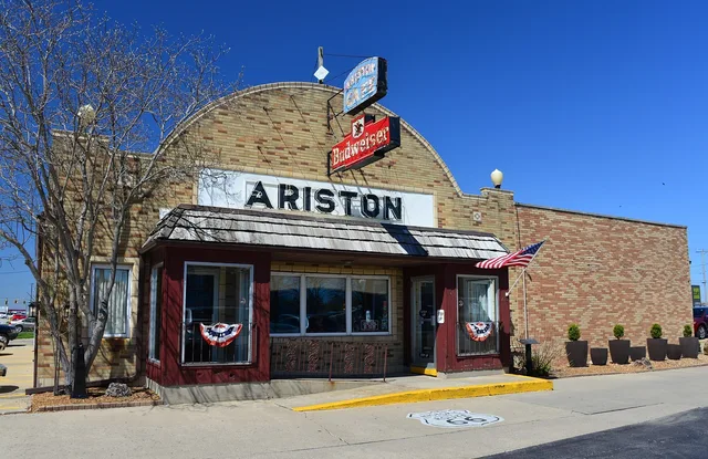
Plan a first stop within the first hour so the day starts with a walk rather than an hour of windscreen viewing. The Ariston Cafe in Litchfield opened in 1924 and still has its Route 66 neon sign. It makes a good first stop.
Day one, midday: the Pontiac Route 66 Museum, with Pompeys Pillar as a model
Plan one staffed or maintained site for midday. It gives shade, a bathroom, and usually the only written history you get all day. These sites take signage seriously.
A model is Pompeys Pillar in Montana, which the BLM says draws 25,000 visitors each season, where a local artist painted murals inside the two small restroom buildings, the first buildings most visitors enter after parking.
On this route, the anchor is the Pontiac Route 66 Museum at 110 W Howard St in Pontiac, Illinois. It is staffed, has restrooms, and holds Route 66 signs, maps, and memorabilia. The museum also sits near the downtown Walldog murals, so you can walk to painted walls after lunch.
Day one, afternoon: Pontiac Walldog murals and town-center ghost signs
Late afternoon light is best on brick, which is what most surviving painted advertisements are on. Work the town centers along the corridor, park once, and walk.
Pontiac has more than 20 Walldog murals, including Route 66 themes, painted on brick walls in the downtown historic district. Look for Route 66 shields and local history in the murals.
Ghost signs are usually on end walls facing the direction the traffic used to come from. That placement is a good way to work out which way the old road ran. In Litchfield, the Ariston Cafe's neon sign faces the old route. In Pontiac, the murals face the sidewalks where drivers once parked.
Day two, morning: Wilmington's Gemini Giant and the FWS mural list
Give the second morning to today's roadside painting and signs. It is easier to find and often more welcoming to visitors. In Wilmington, the Gemini Giant at the Launching Pad Drive-In is a 1965 Muffler Man holding a rocket. The statue and sign stand on Route 66 and make a simple photo stop.
For a modern mural extension, the Fish and Wildlife Service made a driving list of endangered species murals across California, including one in Arcata. That mural stretches more than 250 feet on the back of a building at 280 E Street. Contemporary murals photograph well and are usually walkable from a town parking lot.
Day two, afternoon: Dwight, Odell, Lincoln, Springfield, then I-55 back
Do not retrace the outbound alignment. Take I-55 back and stop only at things you noted on the way out and could not fit. Before that, work the towns. Dwight has the restored 1933 Ambler's Texaco Station. Odell has the restored 1932 Standard Oil Gas Station. Both are former filling stations with original signs and pumps.
Lincoln has The Mill, a 1929 restaurant with a neon sign. Springfield has the Cozy Dog Drive In, which has served corn dogs since 1946. The change of pace is deliberate: it ends the trip with confirmation rather than discovery, and it gets you home at a sensible hour.
Timing rules that make it work
- No more than five timed stops across the two days.
- One hour unassigned each afternoon.
- Fuel at half a tank, not a quarter, in small-town country.
- Last photograph at least an hour before dark, then drive.
- Shoot east-facing signs in the morning and west-facing signs in the evening.
Choose subjects with the type list in sixteen vintage sign types, and if anyone in the party needs shorter walks or firmer surfaces, check the options in accessible ways to see old signage.