Features
Where original Route 66 signs survive across US corridor states
Original Route 66 signs survive mostly on bypassed alignments, and state historic preservation office surveys and National Register listings record where.
What to take away
- Original Route 66 signs are rare, and the ones that survive sit mostly on bypassed alignments rather than on the four-lane interstates that replaced them.
- Porcelain enamel holds on in Missouri and Oklahoma, while neon and painted brick dominate in Texas, New Mexico and California.
- State historic preservation office sign surveys, not private collectors, are the main record of what remains and where.
- National Register of Historic Places listings cover many roadside buildings and districts that carry the signs, which affects what can be altered.
- Reading a sign means standing back, photographing from the public right of way and never touching the enamel or the neon tubing.
What counts as an original Route 66 sign
An original Route 66 sign is a sign made and installed while the road carried that name, roughly 1926 to 1985. The highway was decommissioned in 1985, so anything hung afterward is a reproduction, however good it looks.
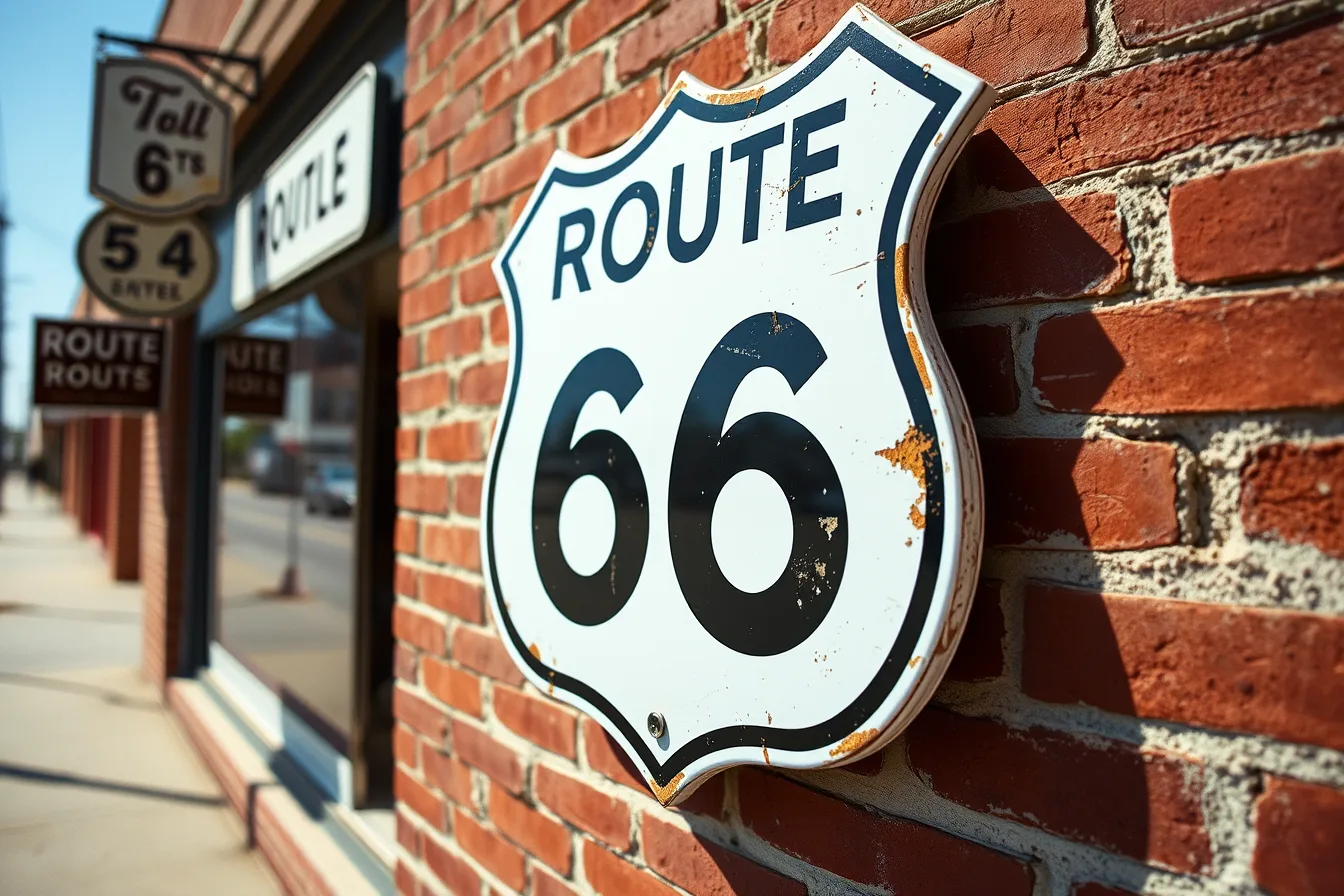
The most sought-after pieces are porcelain enamel shields. These were stamped from steel, coated in powdered glass and fired, which is why so many still hold color after eighty years of sun. The enamel chips rather than fades, and a chipped edge is often the surest proof of age.
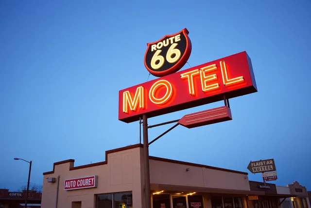
Neon is the second family. Route 66 neon rarely spelled the highway name. It sold motor courts, cafes and garages beside the road, and the highway connection is the address rather than the letters. A 1940s motel sign on a surviving alignment counts as Route 66 material even when the word never appears.
Painted wall signs are the third family. Brick buildings in small downtowns carry ghost signs for tires, bread and oil, applied directly to the wall. They survive because nobody bothered to paint over them.
There is also the hardware question. Mounting brackets and bolt patterns often tell you more about a sign's age than the paint does. That argument runs through our piece on why vintage highway signs hide their story in the hardware.
What does not count is the modern brown and white directional marker. Those were placed by state programs after decommissioning to guide travelers, and they are wayfinding, not history.
The three families at a glance
Material
- Porcelain shield
- Fired enamel on steel
- Neon
- Glass tubing on metal can
- Painted wall
- Oil or lead paint on brick
Typical corridor states
- Porcelain shield
- Missouri, Kansas, Oklahoma
- Neon
- Texas, New Mexico, Arizona, California
- Painted wall
- Missouri, Kansas, Oklahoma, Texas
Where it survives
- Porcelain shield
- Bypassed alignments, small museums
- Neon
- Motor courts, cafes, downtowns
- Painted wall
- Side walls of commercial blocks
Porcelain, neon and painted wall signs by corridor state
Missouri holds the densest surviving concentration of porcelain. The state's older alignments run through small county seats where the highway was the main street, and main streets keep their signage. Look for shields mounted flat on brick rather than on poles.
Kansas has the shortest stretch, a few miles through the southeast corner near Galena and Baxter Springs. That brevity helps. The alignment was bypassed early and the towns had little money to modernize, so older signs stayed up.
Oklahoma carries the longest drivable mileage of any corridor state. Porcelain survives in the northeast, and painted wall signs run through nearly every town square between Miami and Erick. The state also has a strong tradition of restored neon on commercial fronts.
Texas is where neon starts to dominate. The Panhandle towns of Amarillo and Shamrock hold large motor court signs, and the painted brick in McLean and Alanreed is among the best documented on the corridor.
New Mexico mixes neon and Pueblo Revival architecture. Albuquerque's Central Avenue holds the longest urban stretch of the old road in the country, and its signs sit inside a National Register district rather than on isolated parcels.
Arizona leans on neon and on roadside archaeology. Motor court signs in Holbrook, Winslow and Kingman survive, and the state's high desert climate is kind to metal and glass.
California has the most photographed signs and the fewest untouched ones. Neon in San Bernardino, Barstow and Needles has been restored, repainted or rebuilt, so documentation matters more than authenticity of material.
Why the east and west differ
Porcelain was cheap and durable when the eastern corridor states were building their alignments in the late 1920s. By the time the western alignments matured, neon had become the commercial standard for attracting drivers at night. Climate did the rest.
Humidity in Missouri and Oklahoma damages steel but preserves paint, while desert sun in Arizona and California fades paint and spares the glass.
What the corridor states have in common
The United States Route 66 corridor is not one region but seven state preservation systems laid end to end. A sign that would be protected in one state can sit unprotected a few hundred yards across a line. That makes the corridor a patchwork rather than a single protected resource.
Which towns still hold original markers
Start with towns the interstate passed by. When a bypass opened, traffic left and money left with it, and nobody replaced the signs. That is the single best predictor of survival on the whole corridor.
In Missouri, the old alignments through Carthage, Webb City and Joplin hold porcelain and painted signs within a few blocks of each other. In Kansas, Galena and Baxter Springs are compact enough to walk. In Oklahoma, Miami, Vinita, Claremore, Stroud and Erick all reward a slow pass through downtown.
Texas concentrates its best material in the Panhandle. Shamrock's tower sign and McLean's restored complex are the anchors, with Amarillo holding the largest single collection of neon.
New Mexico's survivors cluster in Albuquerque, Santa Fe and Tucumcari. Tucumcari is the outlier: a small town with an unusually dense run of motor court neon along one street.
Arizona's towns are spaced farther apart. Holbrook, Winslow, Williams and Kingman each hold a handful. California's are urban and spread out, so plan on driving between San Bernardino, Barstow and Needles rather than walking.
Choosing where to sleep shapes what you see. Staying in the bypassed town rather than the interstate exit puts you on the street where the signs are, at the hour when neon reads best.
If you have two days rather than two weeks, a vintage highway signs route built on bypassed alignments and painted walls covers more ground than a straight interstate run.
How state historic preservation offices record them
Every corridor state runs a historic preservation office, usually called the SHPO, and those offices are the reason anyone can say what survives. Their role in preservation is defined nationally through the National Park Service's Historic Preservation program, which sets the framework the states work inside.
A sign survey is a field inventory. Staff and volunteers drive an alignment, photograph each sign, record its address and condition, and note whether it is attached to a contributing building. The results go into a statewide database that anyone can request.
Surveys are usually triggered by three things: a road project, a National Register nomination, or a grant with a documentation requirement. A highway widening that touches an old alignment will often produce a sign inventory as a condition of federal review.
What the surveys capture is uneven. Porcelain shields and neon get photographed. Painted wall signs are often missed because they sit above eye level and read as texture rather than signage. Condition ratings are also subjective, and one office's "fair" is another's "poor."
The practical value for a traveler is that survey files often record signs that have since been removed. A 1990s survey photograph may be the only surviving image of a sign that came down in 2005. For anyone trying to date a piece of hardware, those files are the first place to look.
What a survey entry usually contains
- Street address and alignment name
- Sign typeporcelain, neon, painted wall or other
- Photograph, often with a scale or date card
- Condition rating and note of missing elements
- Whether the sign contributes to a listed district
- Owner contact and permission status
- Survey date and the name of the field recorder
National Register listings along the corridor
The National Register of Historic Places is the federal list of districts, sites, buildings and structures worth preserving. Its National Register program pages explain how listing works and what it does and does not restrict.
Listing matters for signs in two ways. First, a listed building with an original sign usually treats that sign as a contributing feature, so removing it can affect the building's status.
Second, a listed commercial district can protect a whole run of signs at once. That is how Albuquerque's Central Avenue and parts of several small downtowns hold their material.
New listings appear constantly, and signs and roadside buildings show up on them. The National Park Service publishes a Weekly List of new nominations and listings, which is the fastest way to see what has just been recognized in a corridor state.
Eligibility is the part travelers get wrong. A sign does not have to be listed to be eligible, and eligibility is often the argument that saves a sign during a road project. The National Register FAQs cover how eligibility is judged and how to cite it when making a case.
Listing is largely honorary at the federal level. It does not force an owner to keep a sign, and it does not open a building to the public. What it does is create a review process when federal money or permits are involved, which is often enough to slow a demolition.
How a sign gets recognized
- A survey or a local group documents the sign and the building it sits on.
- A nomination is prepared, usually with the state historic preservation office.
- The state review board votes on whether to forward the nomination.
- The National Park Service reviews it and either lists the property or returns it for more work.
- The listing appears on the Weekly List and in the state's records.
Reading a surviving sign without damaging it
Most damage to old signs comes from people who mean well. Touching enamel transfers skin oils into chips and speeds corrosion. Leaning a ladder against a pole cracks porcelain and bends brackets that are already fatigued.
Photograph from the public right of way. A sidewalk or a street shoulder is usually enough, and a modest zoom beats standing in someone's lot.
Shoot in flat light when you can. Direct sun blows out white porcelain and hides the crazing that tells you a sign is old. Overcast mornings are best for enamel, and dusk is best for neon.
Never handle neon tubing, even switched off. Old transformers hold a charge and the glass is thin. If a sign is dark, photograph the metal can and the brackets instead.
Ask before you enter private property. Many surviving signs sit on working businesses, and a polite request at the counter gets you closer than a fence line ever will. Owners who feel respected tend to keep the sign up.
If a sign is genuinely at risk, the productive move is to document it and connect the owner with people who can help. The National Park Service's guidance on how to protect an important place lays out the routes available to owners and local groups, from local designation to grant programs.
Documentation is also the step that makes everything else possible. Our look at how vintage highway signs survive on documentation done before stabilization explains why a good photo set and a condition report often matter more than money in the first year.
A short field checklist
- Confirm you are on a bypassed alignment, not the interstate
- Note the sign type before you photograph it
- Capture the mounting hardware and the wall behind it
- Record the address and the nearest cross street
- Check the state survey database for an earlier photo
- Leave the sign exactly as you found it
Survey conditions that decide what gets documented next
Funding decides most of it. Sign surveys are usually paid for with federal preservation grants passed through the states, and when that money tightens, field work stops. A corridor state with an active grant cycle will document more in one year than a neighbor will in five.
Staff capacity matters just as much. Most state historic preservation offices run sign surveys with a handful of people and a volunteer pool. A single retirement can stall a multi-year inventory.
Access is the quiet constraint. Surveyors need owner permission for anything off the right of way, and refusals are common on working commercial property. Signs behind a locked gate rarely make it into the record.
Road projects cut both ways. A widening can trigger a survey that documents a stretch nobody had looked at in decades, and it can also take the signs down. The surveys that matter most are the ones completed before construction starts.
Weather sets the calendar. Field seasons in Oklahoma and Texas run in spring and fall, while Arizona and California crews work through winter. A survey planned for August in the Panhandle will produce poor photographs and tired recorders.
Finally, interest shapes coverage. Neon and porcelain attract volunteers, and painted wall signs do not. That bias is visible in every state database along the United States Route 66 corridor, and it is the reason a plain brick wall in a small town is the most likely thing to be lost undocumented.
If you are planning a trip around this material, the signs worth building a route around are the ones already in a survey file, because they are the ones most likely to still be standing when you arrive.
A working list of vintage highway signs worth stopping for is a reasonable starting point, provided you check the survey record before you drive.
Weather and access vary so much between states that the same sign type can be well documented in one and invisible in the next. A traveler crossing the United States Route 66 corridor sees the result: dense records in some states, near silence in others.