Costs
Scenic route case studies cost: six lines to record
A scenic route case studies cost checklist: the six lines to record, how to handle vehicle wear on unpaved roads, and why free activities still cost money.

Archive
Costs
A scenic route case studies cost checklist: the six lines to record, how to handle vehicle wear on unpaved roads, and why free activities still cost money.
Features
Six formats for scenic route case studies: the same road in two seasons, a single theme trip, an unfinished route, a services study and a one variable repeat.
Reviews
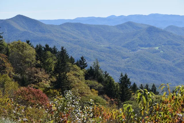
Use scenic route case studies to check a guided tour: match its timings, stops and wildlife claims to agency route data, with a Blue Ridge Parkway example.
Features
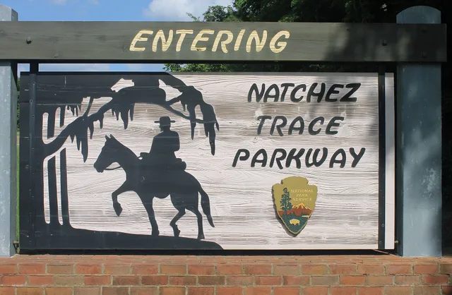
Scenic route case studies field checklist: document the Natchez Trace Parkway with signs, surface frames, timestamps, location data, and a filing example.
Industry
How to build a reusable scenic route case study: the fields to record, the conditions to log, how to split the numbers, and what makes a lesson transferable.
Maintenance
Roadside navigation apps tips for scenic routes: check road surfaces, budget time for stops, prepare offline maps and keep your phone usable in remote areas.
Guides
A roadside navigation apps itinerary template for testing signal loss, offline maps, service stops and unpaved roads, with Oregon examples and a field log.
Features
Going-to-the-Sun Road and the Badlands Loop Road show how brown byway markers and wayside panels explain glacial and sedimentary rock across one long drive.
Features
How Michigan, Wisconsin and Ohio sign Great Lakes shoreline byways, from Sleeping Bear dune overlooks to the Edmund Fitzgerald bell at Whitefish Point.
Features
Line by line look at what a scenic byway guided day tour quote covers: transport, admissions, permits and gratuities, plus what gets billed on the day.
Features
Limestone in the Flint Hills, Niobrara Chalk near Monument Rocks and Sandhills sand: which Kansas and Nebraska byway signs name each rock and where to pull over.
Features
A sign-by-sign guide to timing scenic byway pull-offs, with stop budgets, a day clock, and the marker types worth braking for on a long drive.
Features
A first-timer's look at the signs, markers and pull-offs on the Trans-Canada and Yellowhead highways through the Canadian Rockies, compared sign by sign.
Features
A west-of-Alberta comparison of Trans-Canada and Yellowhead roadside sign quality, photo value and record-keeping, with source, replica and documentation paths.
Rules
For USA travel, map apps can route you to scenic overlooks and roadside attractions, but agency pages and site staff supply the access details worth saving.
Reviews
Which navigation apps hold up on a scenic byway and which only look good, judged on offline maps, road detail, live traffic and honest failure.
Industry
Find and judge local guides at historic roadside sites: where to look, the questions to ask, and when road trip tour companies are the better hire.
Features
Cascade Lakes Scenic Byway near Bend runs on volcanic rock, while Rapid City's Black Hills routes and Needles Highway cut granite. Here is how each is signed.
Features
Blue Ridge Parkway signage follows National Park Service rules, while Route 66 markers rely on state surveys. Here is how each system works.
Guides
Colorado backroad signs use green guide panels to point drivers toward roads and destinations, but the color does not describe pavement or upkeep.
Guides
Drone rules roadside attractions photographers need include FAA flight limits, park and public-land closures, and state trespass rules at the fence line.
Guides
FHWA National Scenic Byway status leaves the route number alone and adds a byway name panel, the America's Byways logo and grant-funded markers.
Features
Route 66 neon signs in Flagstaff and Barstow need documenting now. Use National Register listings and SHPO surveys to record them before they go.
Guides
Three signed red rock corridors out of Moab and Santa Fe plus the highway agencies that post and maintain each route marker along these scenic byways.
Features
Original Route 66 signs include porcelain shields, neon and painted walls. See how materials, mounting hardware and setting help explain historic examples.
Guides
Six named road trip tour operators compared on the parks and routes they cover, their stated group caps, and what to ask about single supplements and gratuities before you pay.
Costs
Roadside photography trip costs stack up from national park entrance fees, state park day fees, BLM passes, film permits and sales tax on gear.
Guides
US scenic byway seasons bring spring flood risk on Utah's Scenic Byway 12, heat on the Trail of the Ancients, and early snow on Colorado's San Juan Skyway.
Industry
A practical guide to vetting road trip tour companies for scenic-route access, with checks for land permissions, itineraries, stops, timing, and closures.
Guides
Colorado backroad green sign meaning: those small green markers on gravel roads are county road numbers, not state rules. Here is how to read them.
Guides
Roadside sign documentation: how to build a source file for one marker or attraction, with evidence, credits, version notes and a clean handoff.
Guides
Keep a field log of scenic route signs and roadside attractions: set up before the drive, log three lines at the stop, check and close entries in the evening.
Guides
Scenic route signs and roadside markers make claims. Here is how to check a sign's meaning, name the sponsor on a plaque and find the official byway record.
Guides
Interstate vs backroad scenic detour signs compared on Kansas and Nebraska corridors: what blue exit signs promise and what US route markers actually deliver.
Guides
Seven Iowa roadside stops from Sioux City to Dubuque, with drive times between legs, typical stop times and which one to cut first on a two day route.
Guides
Scenic byway sign meaning, decoded: brown panels, national shields and state markers read as one system. Here is how the MUTCD rules decide what each one says.
Costs
Explore replica Ontario heritage road signs through six named seller options, broad cost context, material differences, and practical ordering considerations.
Guides
Scenic byway signs tell you who owns a route, what a brown marker means and which roadside stops reward the detour. Check these before you pull over.
Guides
Use repeating route markers to confirm you are on a scenic byway, treat a gap as a missed turn, and read green, blue and brown signs for fuel and detours.
Guides
Scenic route signs tell you who designated a road and who keeps the marker painted. Here is what to record at each pull-off before you drive on.
Guides
State welcome center scenic byway maps depend on the last print run. Who to ask instead, from Visit New Hampshire to Vermont's byways office, and what to say.
Guides
Trans-Canada vs Yellowhead roadside attraction signs: which Alberta corridor delivers more signposted stops per kilometre, and where each route wins.
Guides
A Turquoise Trail itinerary on NM-14 between Santa Fe and Albuquerque, with drive times, Madrid, Cerrillos and Golden stops, and what to cut when time is short.
Costs
Explore Route 66 signs, museums and restoration basics, with questions to ask about vintage neon sign restoration tour cost before booking.
Costs
Roadside trip mistakes cost time and money: a hypothetical detour and park fees, plus vehicle upgrades for Montana's paved Big Sky Back Country Byway.
Features
How to pick a daily rescue stop on a long road trip: staffed interpretive centers, hatcheries that work in poor weather, and service stops with real facilities.
Features
A roadside trip mistakes field guide for photographers, with safer pull-offs, FAA and site-specific drone rules, wildlife distances, and essential frames.
Guides
The vehicle rating question that prevents most roadside trip mistakes in 2027 is what the specific route segment is rated for in the operator's own words.
Maintenance
Roadside trip mistakes can derail scenic drives; learn practical checks for closures, fire rules, seasonal access, fuel and roadside stops.
Industry
USA travel readers can compare camping at Sand Wash and Shelf Road, including dirt-road access, campsite facilities, and Shelf Road's Gold Belt Tour history.
Maintenance
Highway itinerary planning tips for scenic drives: set a repeatable daily target, plan wildlife margins, and follow a two-day Blue Ridge Parkway example.
Guides
Highway itinerary planning for two days: pick a 120 to 160 mile loop, set the overnight point first, and place the buffers where they survive.
Rules
USA travel with access needs: build a highway day from confirmed accessible stops, using the BLM map, the Blue Ridge Parkway milepost list and the Access Pass.